| Magnitude | 4.4 |
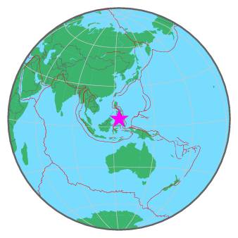
| Region | CELEBES SEA |
| Date time | 2017-02-19 15:31:47.0 UTC |
| Location | 5.833 ; 123.964 |
| Depth | 543 km |
| Distance | 123 km SW of Koronadal, Philippines / pop: 125,000 / local time: 23:31:47.0 2017-02-19 49 km SSW of Palimbang, Philippines / pop: 4,800 / local time: 23:31:47.0 2017-02-19 |
All data providers for this event:
GeoForschungsZentrum (GFZ) -- Potsdam, Germany (GFZ)Geophysical Survey of the Russian Academy of Sciences -- Obninsk, Russia (GSRAS)
National Earthquake Information Center, U.S. Geological Survey -- Golden, United States (NEIC)
Philippine Inst. of Volcanology and Seismology, Quezon City, Philippines -- Manila, Philippines (PIVS)
Further information can be found at:
GeoForschungsZentrum (GFZ) -- Potsdam, Germany (GFZ)Philippine Inst. of Volcanology and Seismology, Quezon City, Philippines -- Manila, Philippines (PIVS)
National Earthquake Information Center, U.S. Geological Survey -- Golden, United States (NEIC)
Badan Meteorologi, Klimatologi dan Geofisika -- Jakarta, Indonesia (BMKG)