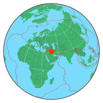
| Magnitude | 5.1 |
| Region | IRAN-IRAQ BORDER REGION |
| Date time | 2017-11-20 15:23:41.9 UTC |
| Location | 32.817 ; 46.424 |
| Depth | 20 km |
| Distance | 66 km NE of Al Kūt, Iraq / pop: 315,000 / local time: 18:23:41.9 2017-11-20 47 km NW of ‘Alī al Gharbī, Iraq / pop: 19,700 / local time: 18:23:41.9 2017-11-20 |
All data providers for this event:
National Institute for Earth Physics -- Bucharest, Romania (NIEP)Seismological Survey of Serbia -- Belgrade, Serbia (BEO)
Laboratoire de Detection et de Geophysique -- Bruyeres-le-Chatel, France (LDG)
GeoForschungsZentrum (GFZ) -- Potsdam, Germany (GFZ)
HUN-REN EPSS Kövesligethy Radó Seismological Observato -- Budapest, Hungary (BUD)
Republican Seismic Survey Center or Azerbaijan National Academy of Sciences -- Baku, Azerbaijan (RSSC)
Geophysical Survey of the Russian Academy of Sciences -- Obninsk, Russia (GSRAS)
Kandilli Observatory and Earthquake Research Institute -- Istanbul, Turkey (KOERI)
National Earthquake Information Center, U.S. Geological Survey -- Golden, United States (NEIC)
GeoSphere Austria -- Vienna, Austria (GSA)
Disaster and Emergency Management Presidency, Earthquake Department (AFAD) -- Ankara, Turkey (AFAD)
Institute of Geophysics, University of Tehran -- Tehran, Iran (IGUT)
Further information can be found at:
International Institute for Earthquake Engineering and Seismology -- Tehran, Iran (IIEES)Institute of Geophysics, University of Tehran -- Tehran, Iran (IGUT)
Geophysical Survey of the Russian Academy of Sciences -- Obninsk, Russia (GSRAS)