| Magnitude | 4.9 |
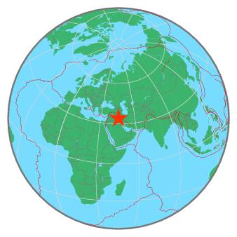
| Region | IRAN-IRAQ BORDER REGION |
| Date time | 2020-08-09 09:16:19.7 UTC |
| Location | 34.069 ; 45.553 |
| Depth | 15 km |
| Distance | 94 km WNW of Īlām, Iran / pop: 140,000 / local time: 13:46:19.7 2020-08-09 36 km N of Mandalī, Iraq / pop: 29,700 / local time: 12:16:19.7 2020-08-09 |
All data providers for this event:
GeoForschungsZentrum (GFZ) -- Potsdam, Germany (GFZ)Republican Seismic Survey Center or Azerbaijan National Academy of Sciences -- Baku, Azerbaijan (RSSC)
Instituto Portugues do Mar e da Atmosfera -- Lisbon, Portugal (IPMA)
Bundesanstalt fur Geowissenschaften und Rohstoffe, German Regional Seismograph Network -- Hannover, Germany (BGR)
National Earthquake Information Center, U.S. Geological Survey -- Golden, United States (NEIC)
GeoSphere Austria -- Vienna, Austria (GSA)
Disaster and Emergency Management Presidency, Earthquake Department (AFAD) -- Ankara, Turkey (AFAD)
Institute of Geophysics, University of Tehran -- Tehran, Iran (IGUT)
National Institute for Earth Physics -- Bucharest, Romania (NIEP)
Laboratoire de Detection et de Geophysique -- Bruyeres-le-Chatel, France (LDG)
ELKH EPSS Kovesligetyh rado Seismological Observatory -- Budapest, Hungary (BUD)
International Institute for Earthquake Engineering and Seismology -- Tehran, Iran (IIEES)
Badan Meteorologi, Klimatologi dan Geofisika -- Jakarta, Indonesia (BMKG)
Geophysical Survey of the Russian Academy of Sciences -- Obninsk, Russia (GSRAS)
Kandilli Observatory and Earthquake Research Institute -- Istanbul, Turkey (KOERI)
Further information can be found at:
International Institute for Earthquake Engineering and Seismology -- Tehran, Iran (IIEES)Geophysical Survey of the Russian Academy of Sciences -- Obninsk, Russia (GSRAS)
Institute of Geophysics, University of Tehran -- Tehran, Iran (IGUT)