| Magnitude | 4.2 |
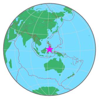
| Region | CELEBES SEA |
| Date time | 2020-11-21 21:25:50.0 UTC |
| Location | 3.453 ; 123.972 |
| Depth | 407 km |
| Distance | 324 km SSW of General Santos, Philippines / pop: 679,000 / local time: 05:25:50.0 2020-11-22 240 km NW of Manado, Indonesia / pop: 451,000 / local time: 05:25:50.0 2020-11-22 |
All data providers for this event:
GeoForschungsZentrum (GFZ) -- Potsdam, Germany (GFZ)Badan Meteorologi, Klimatologi dan Geofisika -- Jakarta, Indonesia (BMKG)
National Earthquake Information Center, U.S. Geological Survey -- Golden, United States (NEIC)
Philippine Inst. of Volcanology and Seismology, Quezon City, Philippines -- Manila, Philippines (PIVS)
Further information can be found at:
Badan Meteorologi, Klimatologi dan Geofisika -- Jakarta, Indonesia (BMKG)GeoForschungsZentrum (GFZ) -- Potsdam, Germany (GFZ)
Philippine Inst. of Volcanology and Seismology, Quezon City, Philippines -- Manila, Philippines (PIVS)
National Earthquake Information Center, U.S. Geological Survey -- Golden, United States (NEIC)