| Magnitude | 5.2 |
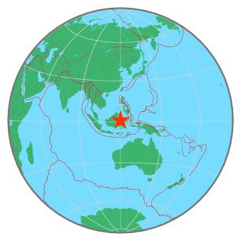
| Region | MINAHASA, SULAWESI, INDONESIA |
| Date time | 2021-01-11 01:57:26.8 UTC |
| Location | 1.040 ; 120.013 |
| Depth | 10 km |
| Distance | 361 km NE of Samarinda, Indonesia / pop: 355,000 / local time: 09:57:26.8 2021-01-11 217 km N of Palu, Indonesia / pop: 282,000 / local time: 09:57:26.8 2021-01-11 |
All data providers for this event:
Geoscience Australia, Canberra, ACT, Australia -- Canberra, Australia (AUST)GeoForschungsZentrum (GFZ) -- Potsdam, Germany (GFZ)
Badan Meteorologi, Klimatologi dan Geofisika -- Jakarta, Indonesia (BMKG)
Geophysical Survey of the Russian Academy of Sciences -- Obninsk, Russia (GSRAS)
National Earthquake Information Center, U.S. Geological Survey -- Golden, United States (NEIC)
Further information can be found at:
Philippine Inst. of Volcanology and Seismology, Quezon City, Philippines -- Manila, Philippines (PIVS)GeoForschungsZentrum (GFZ) -- Potsdam, Germany (GFZ)
National Earthquake Information Center, U.S. Geological Survey -- Golden, United States (NEIC)
Badan Meteorologi, Klimatologi dan Geofisika -- Jakarta, Indonesia (BMKG)