| Magnitude | 4.6 |
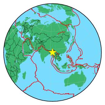
| Region | MYANMAR-INDIA BORDER REGION |
| Date time | 2017-06-18 22:35:48.9 UTC |
| Location | 24.672 ; 94.171 |
| Depth | 40 km |
| Distance | 28 km ESE of Imphāl, India / pop: 223,000 / local time: 04:05:48.9 2017-06-19 18 km ENE of Thoubāl, India / pop: 44,400 / local time: 04:05:48.9 2017-06-19 |
All data providers for this event:
GeoForschungsZentrum (GFZ) -- Potsdam, Germany (GFZ)Laboratoire de Detection et de Geophysique -- Bruyeres-le-Chatel, France (LDG)
Republican Seismic Survey Center or Azerbaijan National Academy of Sciences -- Baku, Azerbaijan (RSSC)
Geophysical Survey of the Russian Academy of Sciences -- Obninsk, Russia (GSRAS)
National Earthquake Information Center, U.S. Geological Survey -- Golden, United States (NEIC)
India Meteorological Department, New Delhi, India -- New Delhi, India (NDI)
Further information can be found at:
Geophysical Survey of the Russian Academy of Sciences -- Obninsk, Russia (GSRAS)National Earthquake Information Center, U.S. Geological Survey -- Golden, United States (NEIC)
GeoForschungsZentrum (GFZ) -- Potsdam, Germany (GFZ)
India Meteorological Department, New Delhi, India -- New Delhi, India (NDI)