| Magnitude | 5.0 |
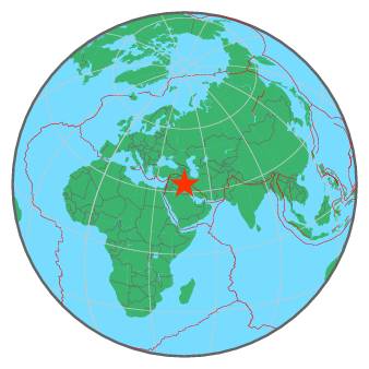
| Region | IRAN-IRAQ BORDER REGION |
| Date time | 2018-01-11 07:54:59.8 UTC |
| Location | 33.656 ; 45.751 |
| Depth | 10 km |
| Distance | 62 km W of Īlām, Iran / pop: 140,000 / local time: 11:24:59.8 2018-01-11 21 km ESE of Mandalī, Iraq / pop: 29,700 / local time: 10:54:59.8 2018-01-11 |
All data providers for this event:
National Institute for Earth Physics -- Bucharest, Romania (NIEP)Seismological Survey of Serbia -- Belgrade, Serbia (BEO)
GeoForschungsZentrum (GFZ) -- Potsdam, Germany (GFZ)
Laboratoire de Detection et de Geophysique -- Bruyeres-le-Chatel, France (LDG)
HUN-REN EPSS Kövesligethy Radó Seismological Observato -- Budapest, Hungary (BUD)
Geophysical Survey of the Russian Academy of Sciences -- Obninsk, Russia (GSRAS)
Instituto Portugues do Mar e da Atmosfera -- Lisbon, Portugal (IPMA)
Kandilli Observatory and Earthquake Research Institute -- Istanbul, Turkey (KOERI)
Bundesanstalt fur Geowissenschaften und Rohstoffe, German Regional Seismograph Network -- Hannover, Germany (BGR)
National Earthquake Information Center, U.S. Geological Survey -- Golden, United States (NEIC)
Disaster and Emergency Management Presidency, Earthquake Department (AFAD) -- Ankara, Turkey (AFAD)
Institute of Geophysics, University of Tehran -- Tehran, Iran (IGUT)
Further information can be found at:
Institute of Geophysics, University of Tehran -- Tehran, Iran (IGUT)International Institute for Earthquake Engineering and Seismology -- Tehran, Iran (IIEES)
Geophysical Survey of the Russian Academy of Sciences -- Obninsk, Russia (GSRAS)