| Magnitude | 4.7 |
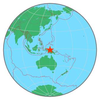
| Region | NEAR N COAST OF PAPUA, INDONESIA |
| Date time | 2019-02-16 11:01:52.9 UTC |
| Location | -2.457 ; 140.162 |
| Depth | 12 km |
| Distance | 1098 km NW of Port Moresby, Papua New Guinea / pop: 283,000 / local time: 21:01:52.9 2019-02-16 62 km W of Jayapura, Indonesia / pop: 134,000 / local time: 20:01:52.9 2019-02-16 |
All data providers for this event:
GeoForschungsZentrum (GFZ) -- Potsdam, Germany (GFZ)Malta Seismic Network, Seismic Monitoring and Research Unit (SMRU), University of Malta -- Imsida, Malta (MLT)
Badan Meteorologi, Klimatologi dan Geofisika -- Jakarta, Indonesia (BMKG)
Geophysical Survey of the Russian Academy of Sciences -- Obninsk, Russia (GSRAS)
National Earthquake Information Center, U.S. Geological Survey -- Golden, United States (NEIC)
Further information can be found at:
GeoForschungsZentrum (GFZ) -- Potsdam, Germany (GFZ)Badan Meteorologi, Klimatologi dan Geofisika -- Jakarta, Indonesia (BMKG)
National Earthquake Information Center, U.S. Geological Survey -- Golden, United States (NEIC)