| Magnitude | 4.5 |
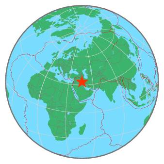
| Region | IRAN-IRAQ BORDER REGION |
| Date time | 2019-04-17 20:02:51.2 UTC |
| Location | 33.278 ; 46.533 |
| Depth | 10 km |
| Distance | 108 km NNE of Al Kūt, Iraq / pop: 315,000 / local time: 23:02:51.2 2019-04-17 41 km SSE of Īlām, Iran / pop: 140,000 / local time: 00:32:51.2 2019-04-18 |
All data providers for this event:
Institute of Geophysics, University of Tehran -- Tehran, Iran (IGUT)National Institute for Earth Physics -- Bucharest, Romania (NIEP)
Ukrainian NDC, Main Center of Special Monitoring -- Kyiv, Ukraine (MCSM)
Seismological Survey of Serbia -- Belgrade, Serbia (BEO)
Laboratoire de Detection et de Geophysique -- Bruyeres-le-Chatel, France (LDG)
GeoForschungsZentrum (GFZ) -- Potsdam, Germany (GFZ)
Malta Seismic Network, Seismic Monitoring and Research Unit (SMRU), University of Malta -- Imsida, Malta (MLT)
HUN-REN EPSS Kövesligethy Radó Seismological Observato -- Budapest, Hungary (BUD)
Badan Meteorologi, Klimatologi dan Geofisika -- Jakarta, Indonesia (BMKG)
Geophysical Survey of the Russian Academy of Sciences -- Obninsk, Russia (GSRAS)
Further information can be found at:
Geophysical Survey of the Russian Academy of Sciences -- Obninsk, Russia (GSRAS)International Institute for Earthquake Engineering and Seismology -- Tehran, Iran (IIEES)
Institute of Geophysics, University of Tehran -- Tehran, Iran (IGUT)