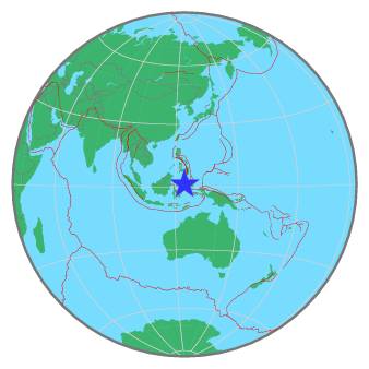
| Magnitude | 5.2 |
| Region | MINAHASA, SULAWESI, INDONESIA |
| Date time | 2021-06-13 01:14:51.7 UTC |
| Location | 1.370 ; 124.502 |
| Depth | 213 km |
| Distance | 533 km S of General Santos, Philippines / pop: 679,000 / local time: 09:14:51.7 2021-06-13 41 km WSW of Manado, Indonesia / pop: 451,000 / local time: 09:14:51.7 2021-06-13 |
All data providers for this event:
Rede Sismografica Brasileira -- Sao Paulo, Brazil (RSBR)Ukrainian NDC, Main Center of Special Monitoring -- Kyiv, Ukraine (MCSM)
GeoForschungsZentrum (GFZ) -- Potsdam, Germany (GFZ)
Republican Seismic Survey Center or Azerbaijan National Academy of Sciences -- Baku, Azerbaijan (RSSC)
Badan Meteorologi, Klimatologi dan Geofisika -- Jakarta, Indonesia (BMKG)
Geophysical Survey of the Russian Academy of Sciences -- Obninsk, Russia (GSRAS)
Kandilli Observatory and Earthquake Research Institute -- Istanbul, Turkey (KOERI)
National Earthquake Information Center, U.S. Geological Survey -- Golden, United States (NEIC)
Further information can be found at:
Philippine Inst. of Volcanology and Seismology, Quezon City, Philippines -- Manila, Philippines (PIVS)GeoForschungsZentrum (GFZ) -- Potsdam, Germany (GFZ)
National Earthquake Information Center, U.S. Geological Survey -- Golden, United States (NEIC)
Badan Meteorologi, Klimatologi dan Geofisika -- Jakarta, Indonesia (BMKG)