| Magnitude | 4.6 |
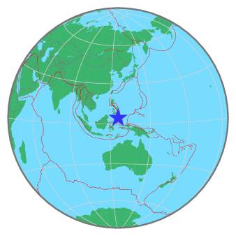
| Region | KEPULAUAN SANGIHE, INDONESIA |
| Date time | 2020-10-17 14:58:15.6 UTC |
| Location | 4.579 ; 125.827 |
| Depth | 175 km |
| Distance | 185 km SE of General Santos, Philippines / pop: 679,000 / local time: 22:58:15.6 2020-10-17 100 km SE of Sarangani, Philippines / pop: 7,500 / local time: 22:58:15.6 2020-10-17 |
All data providers for this event:
GeoForschungsZentrum (GFZ) -- Potsdam, Germany (GFZ)Badan Meteorologi, Klimatologi dan Geofisika -- Jakarta, Indonesia (BMKG)
Geophysical Survey of the Russian Academy of Sciences -- Obninsk, Russia (GSRAS)
National Earthquake Information Center, U.S. Geological Survey -- Golden, United States (NEIC)
Philippine Inst. of Volcanology and Seismology, Quezon City, Philippines -- Manila, Philippines (PIVS)
Further information can be found at:
National Earthquake Information Center, U.S. Geological Survey -- Golden, United States (NEIC)Badan Meteorologi, Klimatologi dan Geofisika -- Jakarta, Indonesia (BMKG)
GeoForschungsZentrum (GFZ) -- Potsdam, Germany (GFZ)
Philippine Inst. of Volcanology and Seismology, Quezon City, Philippines -- Manila, Philippines (PIVS)